Contact
larryf@happy-wanderers.com
Info
Information on this website is our opinion only. This site was created to help others considering this wonderful lifestyle, and for our own use.
larryf@happy-wanderers.com
Information on this website is our opinion only. This site was created to help others considering this wonderful lifestyle, and for our own use.
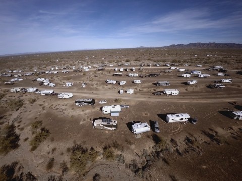
Flying my 3DR Solo sUAS allows me to create aerial "maps". These are similiar to a Google Satellite view, except this map is current and can be zoomed in for greater detail. On January 21st, 2016, I flew a mapping "mission" over Boomerville in Quartzsite, AZ. This is the nickname for the rally location of the Escapees RV Club "Boomers". The result is a current aerial map of our camping area.
This web link will take you to this aerial map. You'll need to answer "yes" to install Microsoft's HD View plug-in, which never got out of development. However, it works just fine. The HD View plug-in allows "giga-pixel" graphics to be displayed on the web. You can zoom in for greater detail and move the map around the screen. Controls can be found in the top-right corner of the map.
Click HERE to see the aerial map of "Boomerville" as of January 21st, 2016
When you subscribe to the blog, we will send you an e-mail when there are new updates on the site so you wouldn't miss them.
Follow